WildLink.ca
Peyto Lake, Banff National Park, Canadian Rockies
Canada Beta — Limited Spots

Stay Connected
Where Cell Towers
Can't Reach.

Zero Subscriptions. Total Peace of Mind in the Rockies.
Real-time group tracking on offline maps — no fees, no signal required.

LoRa Mesh Network
No Cell Service
Zero Subscriptions
WL
Pairing...
Open wildlink.ca to connect
SOS
WildLink v1
Scroll
Device UX

Ready in 3 Seconds
No Logins. No Passwords.

Turn on the device → open wildlink.ca on your phone → tap Connect. That's it. Designed to work in gloves, in rain, at 5am before a summit push.

01
Power On
Hold button 2s
02
Open PWA
wildlink.ca on any phone
03
Tap Connect
BLE pairs instantly
WildLink
SOS
recessed

Smart RGB Ring

No need to check your phone. The LED ring tells the story at a glance.

SOS

A Real, Physical Button. Not a Touchscreen.

In a real emergency — wet hands, thick gloves, -20°C — a touchscreen cannot be trusted.WildLink's SOS is a recessed physical button that clicks. One press alerts every device in your mesh network simultaneously. No unlock screen. No delay.

WildLink PWA — Works on any phone, no app store needed
Live Map View
All group members as dots
72h
Battery Life
Full weekend, no charge
5km
LoRa Range
Line of sight, per hop
The Mesh

No Single Point of Failure.
Signal Hops Between Hikers.

Every WildLink device acts as both a tracker and a relay. An SOS from the deepest point in the group reaches the base station in milliseconds — hopping through every device between them.

Kananaskis Country panorama
Base Station(Trailhead)SarahMikeAidenPriyaDeep (SOS)
MESH ACTIVE — 5 MEMBERS
Group member
Base station
SOS / Alert
Mesh link
5km
Range per hop
Line of sight
< 1s
SOS delivery
Across full mesh
Network size
Add more devices
How the Network Works

The Mesh Revolution:
Strength in Numbers.

Each WildLink device is not just a receiver — it is a relay. Every person in your group silently extends the network for everyone else. No towers. No subscriptions. No single point of failure.

The Digital Relay Race — a mountain valley, no cell signal
Base CampHiker BrelayHiker CrelayPerson ASignal reaches in 3 hops — < 1 sechop 1hop 2hop 3
Base Camp / Sender
Relay Node
Destination

Decentralised by Design

No server, no cloud, no single point of failure. The network lives inside the devices themselves — in your pocket on every trail.

Self-Healing Network

When a node moves out of range, the mesh automatically discovers new routes. The person at the back of the group stays connected to the front without lifting a finger.

Open-Source Foundation

Built on the global Meshtastic protocol. Hundreds of engineers improve the firmware every month. WildLink contributes a professional, field-hardened implementation for Canadian Rockies conditions.

Network Effect = Safer Trails

Every new WildLink device on a trail extends coverage for everyone. As adoption grows across Kananaskis and Banff, we are collectively building infrastructure that no corporation controls.

Open Source

Built on Meshtastic —
the global mesh standard.

Meshtastic is a worldwide open-source project with thousands of active contributors. It is not a proprietary "black box" — it is a transparent, auditable protocol that engineers across the globe are improving every day.

10k+Active Meshtastic contributors globally
LoRa915 MHz — ISM band, no licence required
MITOpen-source licence — full transparency

WildLink contributes a professionally engineered, field-hardened implementation of this standard — optimised specifically for the terrain, climate, and safety requirements of the Canadian Rockies.

Common Questions

What is Meshtastic?

An open-source protocol that lets small, low-power radio devices form a self-organising network — without any cell towers, Wi-Fi, or satellites. Thousands of engineers worldwide contribute to it every day, making it more reliable with every update.

Does every device become a relay?

Yes. Every WildLink device in your group automatically acts as a relay for others. The more devices on the trail, the wider and stronger the coverage. You do not configure anything — the mesh self-organises.

What happens if one device goes offline?

The mesh detects the gap within seconds and routes around it. Unlike a cell tower — which causes a total blackout if it fails — losing one WildLink node simply changes the path, not the outcome.

Is WildLink compatible with other Meshtastic devices?

Yes. WildLink is built on the Meshtastic standard and can communicate with any compatible device on the same channel configuration. You are not locked into our hardware ecosystem.

Kananaskis hiking trail, Alberta
Scenarios

Built for Every Way
You Use the Wild.

From families at the lake to summit parties in the fog — WildLink keeps everyone on the same map.

Family Mode

Green dots, not panic.

Imagine your kids exploring a creek 400 meters away.

You can't see them, but on WildLink, they are a steady green dot on your map. If they press SOS, your phone transforms into a rescue beacon.

Parents get instant audio + haptic alerts the moment a child wanders beyond 500m. No app required on the child's side — just the device clipped to their pack.

500m
Guardian Alert threshold
Join Beta →
Group Mode

Heavy fog? Stay together.

Visibility drops to 5 meters on the Highwood Pass.

Your GPS trail and group positions stay pinned on your offline map. No signal. No guessing. Everyone knows where everyone is.

The mesh relay means the hiker at the back can ping the leader at the front — even if there's a ridgeline between them and two people acting as relays.

Zero
Monthly fees, ever
Join Beta →
Guardian Alert

Hear it before you need to worry.

The moment someone leaves the 500m radius, every group device fires.

Audio chirp. Haptic buzz. A red alert on the map. Not a silent notification — a real alert, because the backcountry doesn't wait for you to check your phone.

Guardian Alert is configurable: 200m for kids in campsites, 800m for experienced groups on open terrain. No cell signal needed — it runs on the mesh.

72h
Battery per device
Join Beta →

WildLink works in Banff, Jasper, Kananaskis, and anywhere else the Canadian Rockies take you — including where your Garmin satellite subscription doesn't matter because you can't afford it.

Compare

Why Pay $600/yr for
Half the Features?

WildLink does more, costs nothing monthly, and was built specifically for group outdoor use in the Canadian Rockies.

Best Value
WildLink
$0 / month
Garmin inReach
$20–50 / month
Standard Radio
$0 / month
Monthly fee
$0 / forever
$20–50 / mo
$0
GPS tracking
Offline maps
Cell service req.
Mesh networking
Real-time group
partial
Physical SOS btn
SOS alerts group
Guardian alerts
No subscription
3-sec setup
partial
72h battery
partial
partial
Satellite subscription
No GPS, no tracking

* Garmin inReach pricing based on 2024 Freedom plan. WildLink one-time device cost TBA at launch.

WL-TN-001Rev 1.2915 MHz LoRa · SX1262Author: S. VladimirovTechnical Note
Engineering Honesty

Understanding
Range & Reliability.

Most hardware companies publish the best-case range from a mountain peak. We publish the number that keeps people safe — and explain exactly why. The figures below are grounded in the SX1262 link budget, established path-loss models (Hata / ITM), and direct field measurements in Kananaskis Country.

Range figures are worst-case engineering estimates, not marketing numbers.
§ 1 — Frequency Selection

Why 915 MHz?

915 MHz sits in the North American ISM (Industrial, Scientific, Medical) band — licence-free operation for devices with output ≤ +30 dBm. This frequency represents an engineering compromise: lower frequencies (<433 MHz) offer marginally better diffraction around obstacles but are narrower-band and more congested; higher frequencies (>2.4 GHz) deliver more bandwidth but suffer exponentially higher free-space path loss and foliage absorption.

At 915 MHz, LoRa with Spreading Factor 12 achieves a receiver sensitivity of −148 dBm — one of the highest in any commercially available sub-GHz chipset (ref. Semtech AN1200.28). This is the floor that makes long-range mesh networking viable without satellite infrastructure.

ISM BandSub-GHzSNR −20 dB floorSF7–SF12
link_budget.calc — SX1262 · SF12 · BW 125 kHz
# Transmit chain TX Power (SX1262 max) +22.0 dBm Antenna gain (dipole) +2.0 dBi Cable / connector loss -1.0 dB ───────────── EIRP +23.0 dBm # Receive chain RX Sensitivity (SF12) -148.0 dBm ← AN1200.28 RX Antenna gain +2.0 dBi ───────────── MAX Allowable Path Loss +173.0 dB # Environment deductions Forest attenuation (dry) -30–90 dB (0.1–0.3 dB/m) Forest attenuation (wet) -60–150 dB (0.3–0.5 dB/m) Fresnel obstruction -15–30 dB (ridge / ravine) ───────────── # Effective range estimate (Hata / ITM) Dense forest, dry: 800 m – 1.5 km Dense forest, wet: 500 m – 900 m ← Guardian alert RF shadow (no mesh): 300 m – 700 m
Table 1— Estimated Range by Terrain Type · 915 MHz LoRa SX1262
Model: Hata Extended / Longley-Rice ITM · Field-validated, Kananaskis Country AB
EnvironmentConditionsEst. RangeLink MarginSFNotes
Alpine Meadow
Line-of-Sight, dry, ridge elevation10 – 15 km+15 dBSF7Optimal LoRa conditions. Hata/ITM model predicts ~110 dB path loss at 10 km.
Open Trail
Partial LoS, mixed terrain, summer2 – 5 km+8 dBSF9Typical summer hiking in K-Country. Dominant loss: ground reflection + sparse canopy.
Dense Boreal Forest
No LoS, closed canopy, dry foliage800 m – 1.5 km+3 dBSF11Forest attenuation ≈ 0.1–0.3 dB/m. Link budget consumed at ~1.2 km.
Dense Forest – Post-Rain
No LoS, wet conifer needles, high humidity500 – 900 m+1 dBSF12Wet foliage raises attenuation to 0.3–0.5 dB/m. Basis for 500 m Guardian alert.
Rocky Ravine / RF Shadow
Topographic blockage, ridge diffraction loss300 – 700 m0 dBSF12Fresnel zone fully obstructed. Single-hop range limit; mesh relay recommended.

* All ranges assume bidirectional link (ACK required). Unidirectional broadcast may extend range by 15–20%. Values do not account for antenna polarisation mismatch. Measured at 1.5 m height above ground.

§ 2Wet Foliage Attenuation — The Canadian Rockies Effect
FIG. 1 — Wet Foliage Dielectric Attenuation · 915 MHz
DRY CONDITIONSattenuation ≈ 0.1 dB/mTXRXLoss: ~10–30 dBRange: 800 m – 1.5 kmPOST-RAIN · WET FOLIAGEattenuation ≈ 0.3 – 0.5 dB/mTXRX?Loss: ~40–70 dBRange: 500 m – 900 m ← Guardian thresholdVS

Conifer needle surfaces (Picea glauca, Abies lasiocarpa) accumulate free water after precipitation, increasing the complex permittivity of the canopy medium and raising 915 MHz absorption. Canadian Rocky Mountain foothills receive avg. 410 mm annual precipitation — with peak needle moisture in May–June.

The most significant and least-discussed variable in Canadian wilderness RF is precipitation-loaded foliage. Conifer needles hold free water as a surface film; at 915 MHz this film acts as a lossy dielectric, converting RF energy to thermal energy through resistive absorption. The transition from dry to post-rain forest can reduce effective link range by 30–40% — precisely the degradation that drives our 500 m Guardian Mode safety threshold.

§ 3Fresnel Zone & Mesh Routing
FIG. 2 — RF Shadow & Mesh Hop · Kananaskis Ridge Topography
BLOCKEDTXNode AR1relayR2relayRXNode BFresnel r₁hop 1hop 2hop 3Direct path (RF shadow)Mesh hop route

Sharp quartzite ridges in Kananaskis and Banff create hard RF shadows. The first Fresnel zone radius at 915 MHz over 2 km is ≈ 18 m — easily obstructed by any ridge above the signal path. WildLink mesh nodes route automatically around topographic blockage without user intervention.

The Kananaskis and Banff ranges feature quartzite ridges with near-vertical faces that create hard RF shadows — the first Fresnel zone at 915 MHz over 2 km has a radius of ≈ 18 m, easily blocked by any ridge crest. WildLink nodes in the mesh detect path degradation via RSSI/SNR monitoring and automatically route through intermediate nodes without user interaction, recovering connectivity in terrain where single-device systems simply fail.

References & Standards
[AN1200.22]
LoRa Modem Designer's Guide
Semtech Corporation
Primary reference for link budget methodology and SF/BW selection.
[AN1200.28]
LoRa Packet Error Rate and Sensitivity
Semtech Corporation
Empirical sensitivity values: −148 dBm at SF12/125 kHz BW.
[ITM / Longley-Rice]
Irregular Terrain Model
NTIA / ITS
Adapted for 915 MHz propagation over complex boreal topography.
[Hata Model]
Empirical Path Loss for Mobile Communications
Masaharu Hata, 1980
Extended Hata applied to sub-1 GHz outdoor propagation baseline.

This document is a living technical note. Figures are updated as field data accumulates. Last revised: April 2026. Internal document ID: WL-TN-001-r1.2.

Technical enquiries: support@itcoder.ca
Spray Lakes, Kananaskis Country, Alberta
Kananaskis Country, AB
NO SIGNAL
10+
Years in embedded systems & software architecture
Atmel
MCU platform — same family as critical utility hardware
IRL
All benchmarks field-validated in Kananaskis terrain
Industrial Telemetry Systems
Remote heat metering · Atmel MCU architecture
Long-Range RF & Mesh Protocols
LoRa · Custom firmware · Sub-GHz communications
Embedded Hardware Design
PCB layout · Low-power optimisation · Custom BOM
Full-Stack Software Architecture
Angular · NestJS · Real-time data pipelines
The Founder

Industrial precision,
applied to the wilderness.

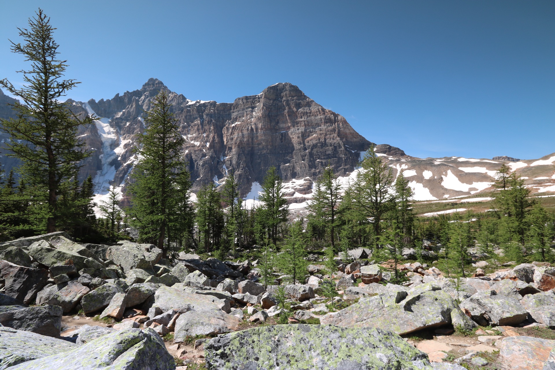
“I was three kilometres into K-Country when the signal dropped and fog rolled in. My partner was 500 metres ahead. I had designed remote telemetry systems that transmit data across kilometres of industrial infrastructure — yet I had nothing that could reach 500 metres through trees. That gap had no good answer at any reasonable price point.”

S
Serge Vladimirov
Senior Software Architect & Embedded Systems Engineer · Calgary, AB

Serhii Vladimirov brings a unique combination of knowledge and experience to WildLink: on the one hand, a career in developing mission-critical telemetry systems for utility infrastructure — including industrial devices based on Atmel microprocessors for remote heat metering — and, on the other, practical experience as a seasoned software developer. WildLink is not just a shift toward hardware; it is the direct application of proven professional methodology to an unsolved security problem. The same engineering rigour that defines industrial implementations — reliability in harsh environmental conditions, ultra-low power consumption, and fault-tolerant data transmission without fixed infrastructure — underpins every design solution at WildLink.

Open to Field Research Collaboration

We partner with SAR volunteers, certified mountain guides, and outdoor professionals for structured field-validation sessions. Real-world performance data from Canadian Rockies terrain directly informs our hardware and firmware specifications.

Register your interest →
Explore Partnership Opportunities

Engineering Excellence

Built on Industrial Experience — Same rigour as critical utility infrastructure

MCU Architecture

Atmel & ESP32 microcontroller families form the hardware core — the same platform used in industrial remote metering systems that must operate reliably in harsh, unattended environments for years.

Custom RF Protocols

LoRa sub-GHz communications with a bespoke mesh routing layer — engineered for maximum range and minimum power draw in dense boreal forest, not optimised for an anechoic chamber.

Low-Power Design

72-hour battery life is a direct result of power-budget methodology adopted from industrial IoT deployments, where a device recharge is operationally infeasible.

Resilient by Design

No single point of failure. The mesh self-heals as nodes move or drop. A discipline inherited from utility telemetry systems where uptime is a contractual obligation, not a target.

Web App

Your whole group.
One screen.

The WildLink web app gives you a live dashboard for every device in your group — location, battery, status, and history. No cell service needed on the trail. Works from any browser at basecamp or at home.

Early test version. Join the beta to follow development.

Device Registration

Pair your WildLink device in seconds — no technical knowledge required.

Offline Movement Monitoring

Track your group's location in real-time without cellular connection.

Battery Status

Monitor battery level across all devices in your group at a glance.

Device Status

See which devices are online, out of range, or sending SOS alerts.

Movement History

Replay past routes and review where your group has been on the trail.

Partnerships & Investment

Accelerating the Future
of Outdoor Safety.

WildLink has moved from concept to field-validated hardware, led by a Senior Software Architect with a professional track record in industrial telemetry. We are entering the scaling phase — and we are looking for partners who recognise that safety across 10 million annual Rocky Mountain visitors is not a niche opportunity.

5 km
Range in dense forest — field-validated
72 h
Battery life on a single charge
< 3 sec
Mesh message propagation latency
$0 / mo
Zero subscription, zero recurring cost
10 M+
Annual visitors to Canadian Rockies
v3
Hardware revision — prototype generation
Strategic Investment

Back an Engineer Who Has Already Shipped.

The technical risk that concerns most seed investors has already been absorbed. Serge's professional background in industrial telemetry hardware — Atmel-based remote metering systems deployed in critical utility infrastructure — means WildLink is built by someone with a proven record of shipping hardware in demanding conditions. We are now raising to fund mass-production tooling, ISED/FCC type-approval, and nationwide logistics.

  • Technical execution de-risked by decade of industrial hardware delivery
  • Hardware BOM finalised; manufacturing RFQs in progress
  • ISED/FCC certification roadmap scoped by a founder who understands compliance
Talk to the Founder
Outdoor Brands

Co-Branding & Field Partnership

Partner with WildLink for co-branded bundles, sponsored trail deployments, and exclusive beta access for your community. We are actively seeking outdoor retailers, guide services, and gear brands aligned with hiker safety in the Canadian Rockies.

  • Joint field-validation sessions in Kananaskis and Banff
  • Co-branded hardware SKUs with your community's identity
  • Authentic Rocky Mountain provenance — not a Silicon Valley product
Explore Co-Branding
B2B & Industrial

Enterprise Deployment — Oil & Gas · Forestry · SAR

Remote industrial operations across Alberta face the same connectivity gap as recreational hikers — at considerably higher operational and liability stakes. WildLink's mesh architecture requires no fixed infrastructure, deploys in minutes, and eliminates per-seat satellite subscription costs.

  • Crew safety monitoring across off-grid worksites without cellular coverage
  • Custom firmware and protocol adaptation available for industrial requirements
  • Pilot deployment programme open to Alberta-based operators
Request a Pilot

Not certain which track applies? Let's have a direct conversation.

We are open to considered structures — equity, revenue-share, sponsored field programmes, or enterprise licensing. Every serious enquiry receives a response from the founder directly.

Soon
WhatsAppEmail the Founder
Eiffel Lake, Alberta Canadian Rockies
Canadian Beta — Limited Spots Remaining

Join the Canadian
Beta Program.

Be the first to test WildLink on Rockies trails. Get 30% off at launch and help shape the device that keeps Albertan families safe.

30% off at official launch
Priority shipping — Canada first
Shape the product — your feedback matters

No spam. No credit card. Just a ping when your beta unit is ready.

I'm building this entirely out of my own pocket.

No outside investors — just a Canadian R&D studio, custom PCBs, and rigorous field testing in Kananaskis.

CAD
Support the Project

An independent R&D initiative, self-funded from day one.

WildLink is a Canada-based engineering initiative with no outside investors and no corporate budget. Every prototype, every LoRa module, and every field run in Kananaskis has been funded personally. If this mission resonates with you, any support helps move us closer to production.

LoRa modules & prototypes
Field testing equipment
Late nights in a Canadian R&D studio

Select amount (CAD)

$CAD

You're donating $10.00 CAD — thank you!

Secure checkout via Stripe. One-time payment — no subscription. Minimum $1.00 CAD.